
Please click text below
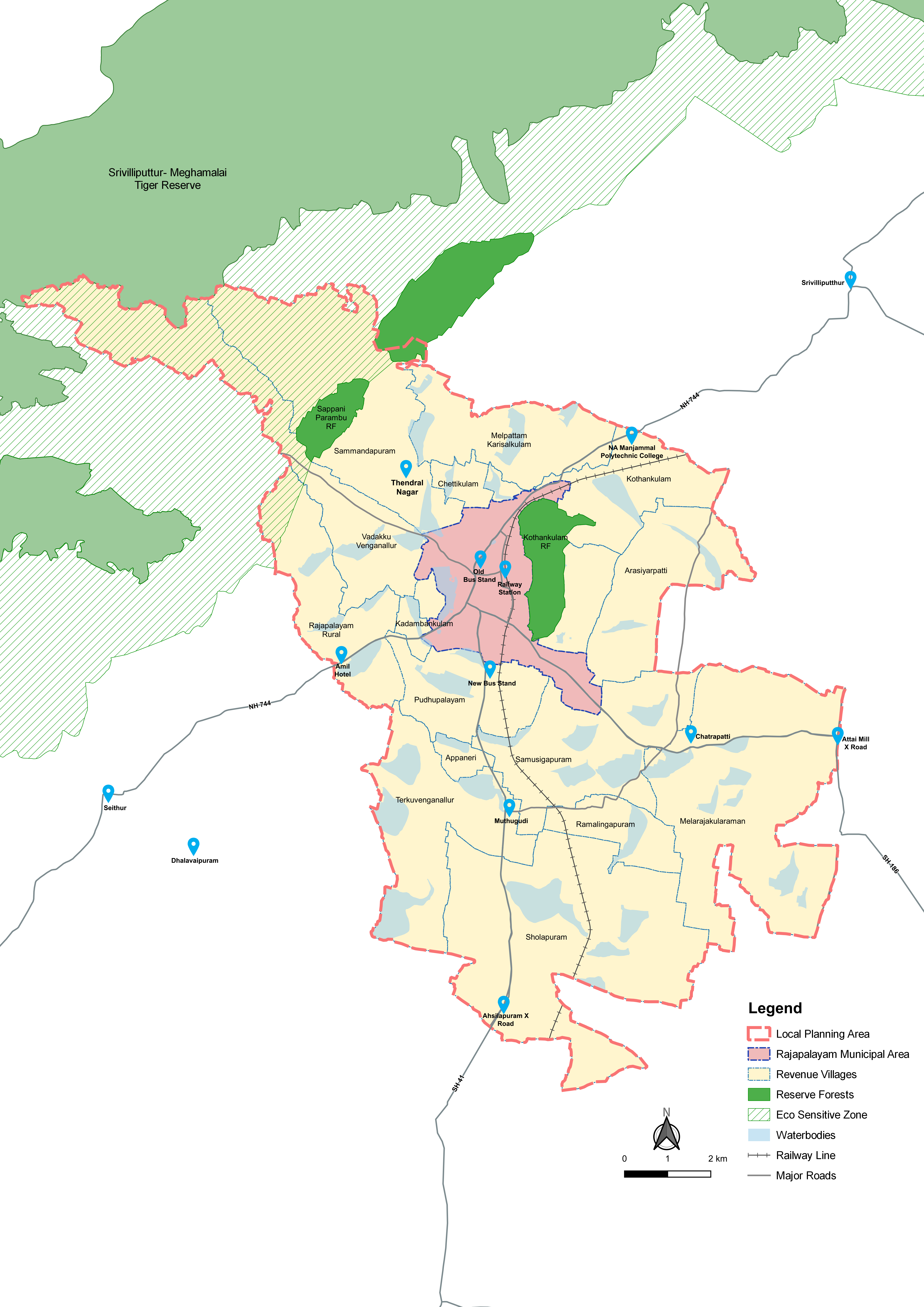
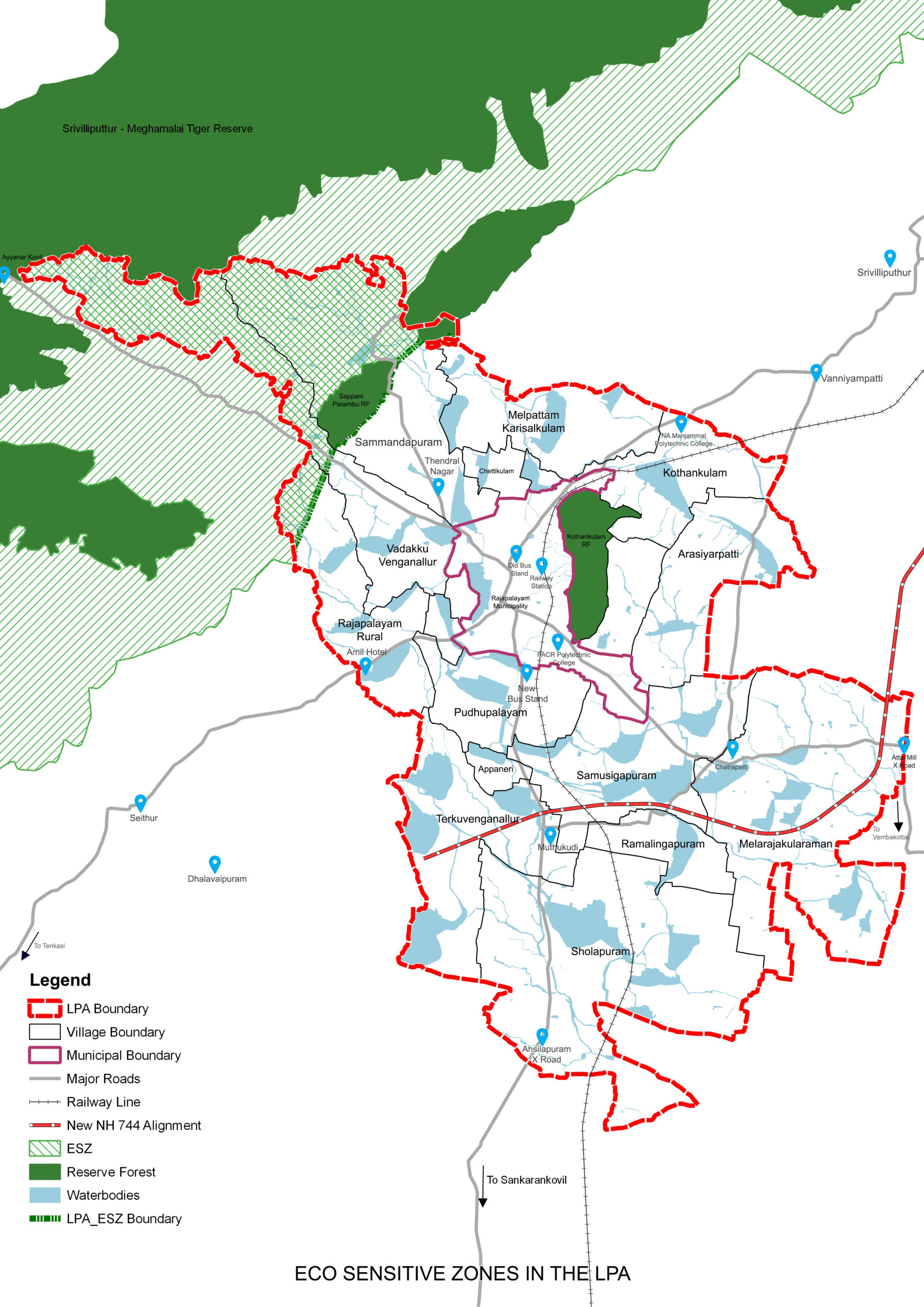
Eco sensitive zone norms followed for SMTR to conserve the eco sensitive zone on foot- hills of Western Ghats, to avoid resource degradation and eliminate and any possible human-wildlife conflict
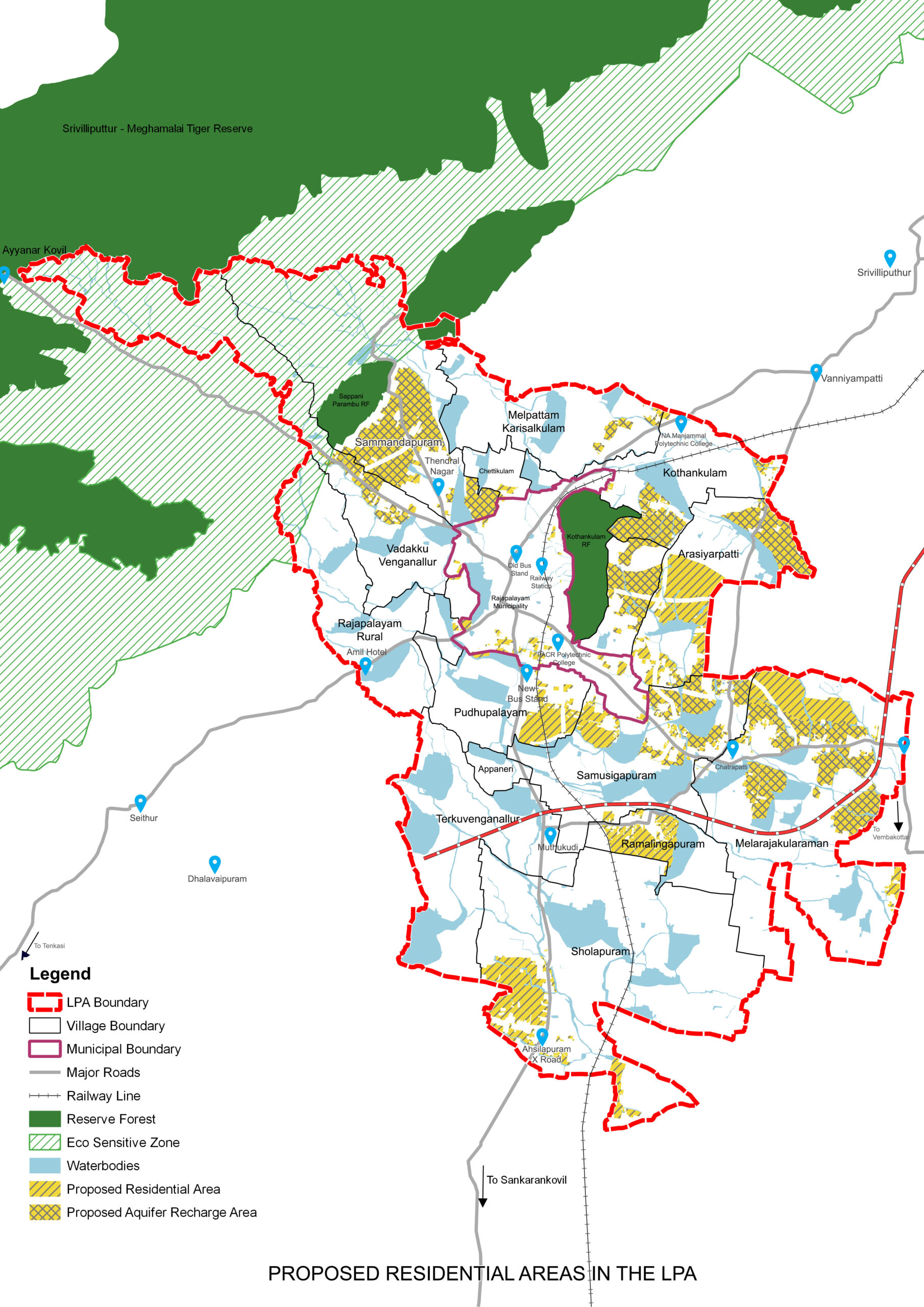
New growth areas for urban extensions are identified around the Municipal area in the villages of Pudhupalayam, Arasiyarpatti, Kothankulam and Sammandhapuram
Phased urban development through Land Pooling and Detailed Development Plans
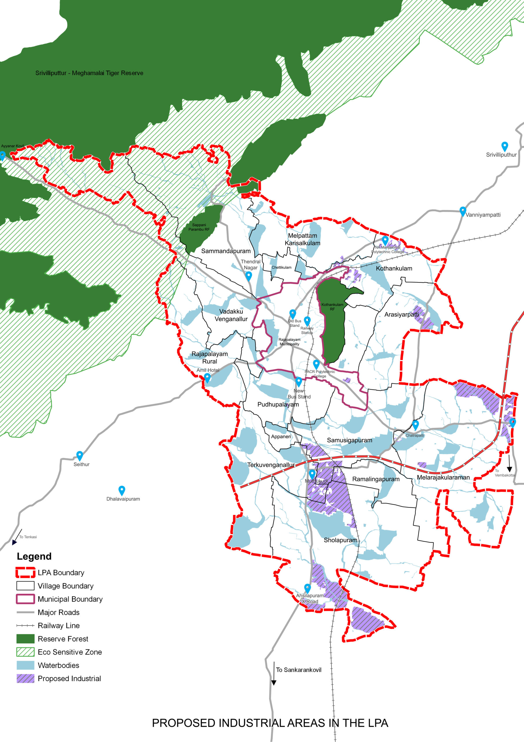
Industrial areas earmarked near Cholapuram and Terkuvengallur, as an extension to SIDCO estate
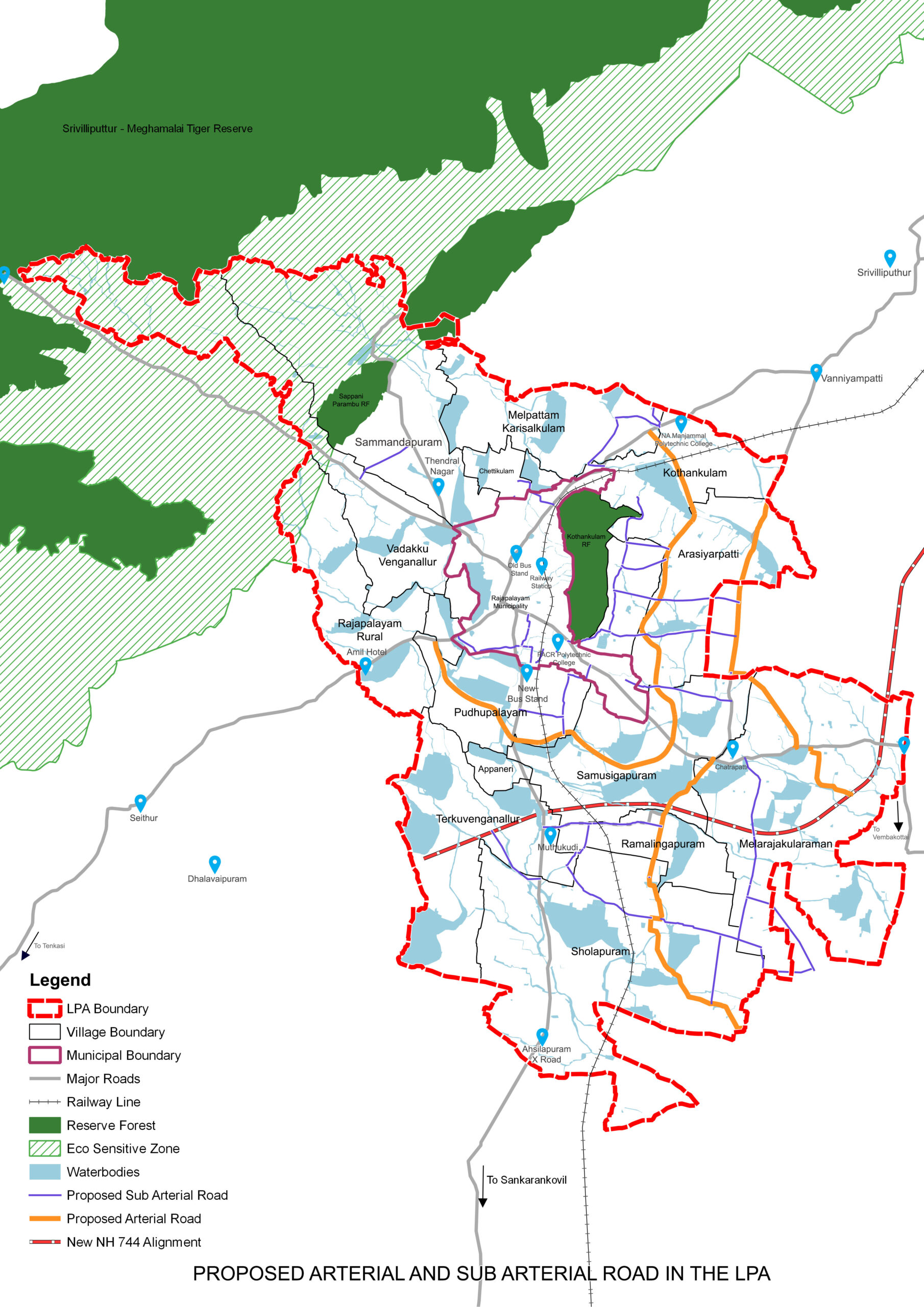
Arterial road (100 feet) and Sub Arterial (80 feet) to solve traffic issues and induce growth
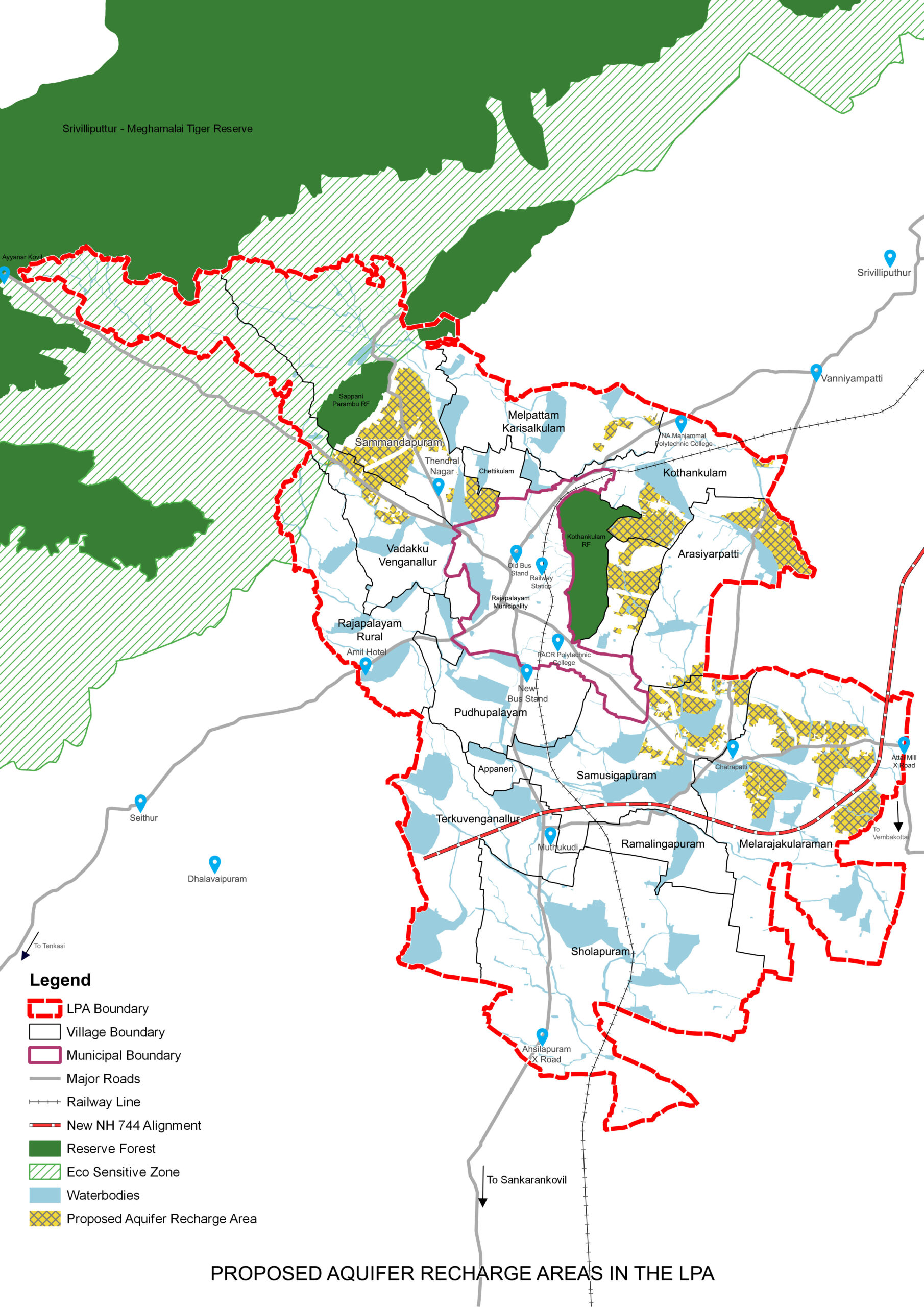
Special emphasis on increasing ground water levels through Aquifer recharge zones
A spatial strategy established in a way to protect 38% of natural Green Blue spaces
All the streams interconnecting the Waterbodies to act as Green Blue walkable corridors to conserve waterbodies and encourage walking
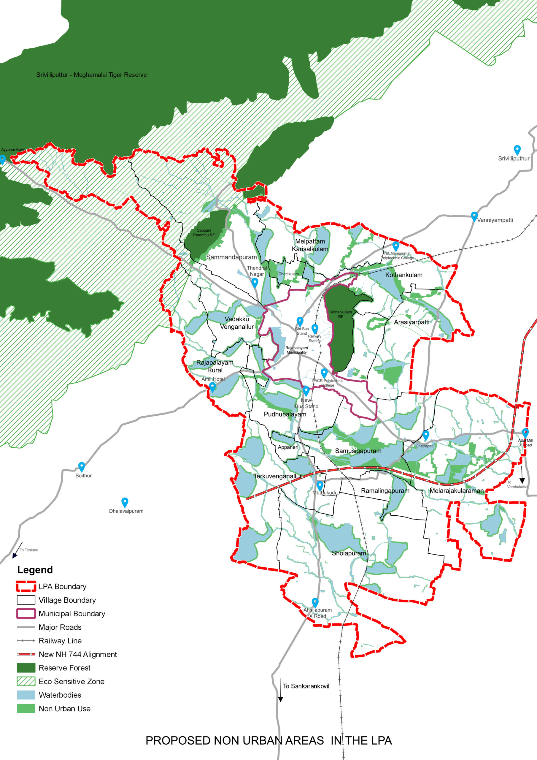
Non-urban spaces used as a shield to protect waterbodies and fertile agriculture lands
Buffers marked for waterbodies & streams, identified as Non-Urban Zones to ensure their protection
Please click text below

Eco sensitive zone norms followed for SMTR to conserve the eco sensitive zone on foot- hills of Western Ghats, to avoid resource degradation and eliminate and any possible human-wildlife conflict
New growth areas for urban extensions are identified around the Municipal area in the villages of Pudhupalayam, Arasiyarpatti, Kothankulam and Sammandhapuram
Phased urban development through Land Pooling and Detailed Development Plans

Industrial areas earmarked near Cholapuram and Terkuvengallur, as an extension to SIDCO estate
Arterial road (100 feet) and Sub Arterial (80 feet) to solve traffic issues and induce growth
Special emphasis on increasing ground water levels through Aquifer recharge zones
A spatial strategy established in a way to protect 38% of natural Green Blue spaces
All the streams interconnecting the Waterbodies to act as Green Blue walkable corridors to conserve waterbodies and encourage walking
Non-urban spaces used as a shield to protect waterbodies and fertile agriculture lands
Buffers marked for waterbodies & streams, identified as Non-Urban Zones to ensure their protection